GPS, GALILEO, GLONASS, BEIDOU, QZSS: What is it and how does it improve your life?
[ad_1]
If you’ve ever checked your smartphone’s specifications, or have gone through its box/paperwork, you must have noticed GPS, GLONASS, BeiDou (BDS), GALILEO, and/or QZSS written in the connectivity section. Wondering what are they? How are these satellite navigation systems different from each other? Well, don’t look further. In this explainer, we go through all the popular satellite navigation systems, learn how they’re all different from each other, and how they all work together to improve your life.
CONTENTSCLOSE
Contents
GPS – Global Positioning System
GPS or Global Positioning System is the most commonly used and oldest navigation system of all. It is a satellite-based navigation system owned by the United States of America. Started as a project in 1978, it was developed and used by the US Department of Defense at first but was then opened to the public in 1994.
GPS doesn’t require internet or cellular communication to work. No matter you’re in the wooded areas or major metropolises with tall buildings (though narrow streets flanked by tall buildings can often block signal), using GPS you can pinpoint your location on a map without having an internet connection (however, it doesn’t work indoors, as the device line of sight and signal is blocked). Using this technology only, even the cheap smartwatches are able to determine your location and track your run — even when they’re not connected to your phone or have an LTE connection built-in.
The system works on the L-Band (Lower Band) of the radio frequency spectrum, i.e, between 1 GHz and 2 GHz. Lower bands were chosen because they allow for a simpler antenna design so the technology can be added to even tiny devices. It also minimizes the effect the weather has on GPS signal propagation.

But how does a GPS-equipped device determine your location?
There are a total of 24 GPS satellites revolving around the Earth. Usually, a device needs to connect to four GPS satellites — with a clear line of sight without any obstructions — to provide the exact geolocation. Out of these four satellites, three are used to narrow down the location of the receiver whereas the fourth one is used to validate the information from the other three. This technique is called trilateration.
First, a satellite broadcasts a signal which is picked up by a GPS device. This is used to calculate the distance of the GPS device to the satellite. However, since a GPS device only gives information about distance, it is not able to provide an exact location from a single satellite.
When a satellite sends a signal, forms a virtual circle around the GPS device with the distance between the GPS device and the satellite as its radius. Then, the same process of sending and receiving signals is done for the second satellite. It also forms a circle around the device. But, this time the GPS device’s location is narrowed down as the device’s location is at one of the two points where the circles intersect.
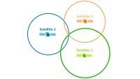
Finally, when the third satellite enters the equation, the GPS device’s location can be found as the device is at the intersection of all three circles. Since the whole system is in the three dimensions, we have to verify the location using the fourth satellite.
In addition to using data from satellites, modern-day GPS devices also use carrier towers, cellular networks, and internet connections to further enhance location accuracy. When the device moves, radius changes, and new circles are formed. Thus we can use this information to determine its speed and elevation, in addition to its position.
GALILEO
GALILEO is a global navigation satellite system built by European Union. The system was introduced by the EU so that European nationals do not have to rely on the United States’ GPS navigation system or Russia’s GLONASS system. It is an independent high-precision positioning system that would continue to work in case of failure of GPS and/or GLONASS. EU’s GALILEO boasts a precision of 1-meter.
GALILEO’s navigation system is divided into three segments:
- Space
- Ground
- User
The space segment is responsible for generating and transmitting code, carrying phase signals, and storing and retransmitting the navigation data. The ground segment is the major system element that connects the GALILEO system, calculates coordinates, and maintains stations. The user segment is made up of GALILEO receivers.
But why does Europe need its own GPS system? EU Agency for the Space Program says that GALILEO will provide over 230,000 jobs. The system is also said to generate over EUR 70 billion in revenue annually when fully available. Moreover, the system is more precise than GPS, as per EUROPA.
The European Commission passed a mandate for all new smartphones to implement GALILEO in 2018. Since then, new smartphones, such as Galaxy S21 and iPhone 13, all are GALILEO enabled. Thanks to GALILEO, Europe now has better emergency services as all the new vehicles sold in Europe are required to support eCall, an automatic emergency response system that dials 112 and transmits Galileo location data in the event of an accident.

GLONASS
GLONASS or Global Navigation Satellite System was developed by Russia as an alternative to GPS. At the time of its launch in the 1980s, it was the second operational satellite-based navigation system with global coverage and of comparable precision.
GLONASS has a total of 24 satellites that provide coverage throughout the world. Although, it offers less accuracy than GPS. GLONASS position accuracy is said to be 5-10m while GPS is 3.5-7.8m. GLONASS doesn’t really have that much advantage over GPS. But since the technology works worldwide, in case GPS isn’t available, GLONASS has your back.
There’s also a version of GLONASS called A-GLONASS or Assisted GLONASS. This technology features turn-by-turn navigation, real-time traffic data, and more. It works in coordination with cell towers to lock precise locations quickly.
BeiDou
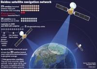
BDS or BeiDou Navigation Satellite System is basically a GPS alternative satellite-based navigation system built by China. The first BeiDou navigation satellite system, called BeiDou-1, was planned in the early 2000s. However, it was decommissioned in 2012. China launched BeiDou-2 (also called COMPASS) in December 2011 and it has been providing services since 2012.
In 2015, China started building the third-generation BeiDou navigation satellite system called BeiDou-3. The goal of the BeiDou-3 navigation satellite is not to provide location services in China only, but globally as well. BeiDou-3 will have 35 satellites when fully launched and will provide millimeter-level accuracy.
As per China National Space Administration, the development of the BeiDou navigation satellite system was carried out in three phases:
- 2000-2003: experimental BeiDou navigation system consisting of three satellites
- By 2012: regional BeiDou navigation system covering China and neighboring regions
- By 2020: global BeiDou navigation system
China originally planned to join forces with European Union in developing Galileo. The Chinese government planned to invest €230 million in the 2003-2006 period in Galileo. However, in 2008, it was reported that China was not satisfied with its involvement in the Galileo project and set to build out its own BeiDou that would compete against GPS, GLONASS, and Galileo.
QZSS
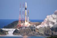
QZSS or Quasi-Zenith Satellite System is a four satellite-based navigation system built by Japan. QZSS satellite system uses one geostationary satellite and three satellites in highly inclined, slightly elliptical, geosynchronous orbits. The main aim of QZSS is to enhance GPS in the Asia-Oceania region, with a focus on Japan.
Due to the small number of GPS satellites in the Oceania region, GPS services were not always stable. QZSS was built to solve this problem. The main purpose of launching QZSS was to increase the availability and performance of GPS in Japan. Since these satellites are compatible with GPS, a little to no change is required in the GPS receiving devices. Compared to standalone GPS, the combined system of GPS + QZSS delivers improved positioning performance.
The first Quasi-Zenith Satellite (QZS-1) launched on September 11, 2010. However, it only had a life of 10 years. Japan has since launched QZS-1R, a satellite that is set to replace the first QZSS satellite. Other than that, three other QZSS satellites launched every two to three years after the original one. The four-satellite constellation has been operational since November 2018. Japan plans to add three more satellites to the fleet increasing the total number to 7 QZSS satellites.
[ad_2]


